26 C 12
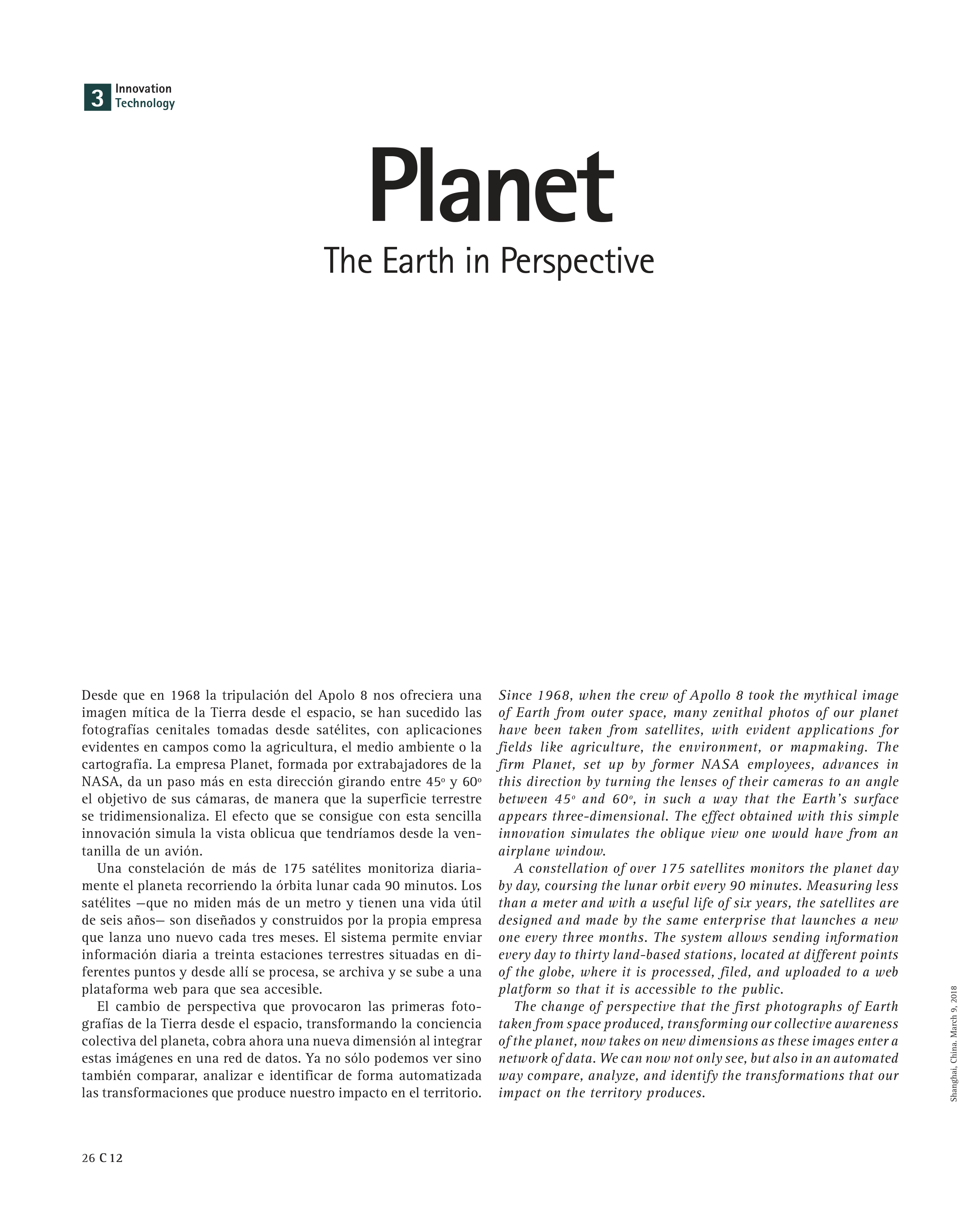
Since 1968, when the crew of Apollo 8 took the mythical image
of Earth from outer space, many zenithal photos of our planet
have been taken from satellites, with evident applications for
fields like agriculture, the environment, or mapmaking. The
firm Planet, set up by former NASA employees, advances in
this direction by turning the lenses of their cameras to an angle
between 45º and 60º, in such a way that the Earth’s surface
appears three-dimensional. The effect obtained with this simple
innovation simulates the oblique view one would have from an
airplane window.
A constellation of over 175 satellites monitors the planet day
by day, coursing the lunar orbit every 90 minutes. Measuring less
than a meter and with a useful life of six years, the satellites are
designed and made by the same enterprise that launches a new
one every three months. The system allows sending information
every day to thirty land-based stations, located at different points
of the globe, where it is processed, filed, and uploaded to a web
platform so that it is accessible to the public.
The change of perspective that the first photographs of Earth
taken from space produced, transforming our collective awareness
of the planet, now takes on new dimensions as these images enter a
network of data. We can now not only see, but also in an automated
way compare, analyze, and identify the transformations that our
impact on the territory produces.
Innovation
Technology
3
Desde que en 1968 la tripulación del Apolo 8 nos ofreciera una
imagen mítica de la Tierra desde el espacio, se han sucedido las
fotografías cenitales tomadas desde satélites, con aplicaciones
evidentes en campos como la agricultura, el medio ambiente o la
cartografía. La empresa Planet, formada por extrabajadores de la
NASA, da un paso más en esta dirección girando entre 45º y 60º
el objetivo de sus cámaras, de manera que la superficie terrestre
se tridimensionaliza. El efecto que se consigue con esta sencilla
innovación simula la vista oblicua que tendríamos desde la ven-
tanilla de un avión.
Una constelación de más de 175 satélites monitoriza diaria-
mente el planeta recorriendo la órbita lunar cada 90 minutos. Los
satélites —que no miden más de un metro y tienen una vida útil
de seis años— son diseñados y construidos por la propia empresa
que lanza uno nuevo cada tres meses. El sistema permite enviar
información diaria a treinta estaciones terrestres situadas en di-
ferentes puntos y desde allí se procesa, se archiva y se sube a una
plataforma web para que sea accesible.
El cambio de perspectiva que provocaron las primeras foto-
grafías de la Tierra desde el espacio, transformando la conciencia
colectiva del planeta, cobra ahora una nueva dimensión al integrar
estas imágenes en una red de datos. Ya no sólo podemos ver sino
también comparar, analizar e identificar de forma automatizada
las transformaciones que produce nuestro impacto en el territorio.
Planet
The Earth in Perspective
Shanghai, China. March 9, 2018